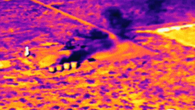
Screenshot from the satellite images of the USí Permian oil fields provided by the Environmental Defense Fund (Retrieved from CBS News)
The largest oil-producing area in the US is spewing more than twice the amount of methane emissions than previously thought, satellite images reveal.
Satellite images have revealed that the oil and gas operations in the Permian Basin, the largest oil-producing area in the United States, are spewing more than twice the amount of methane emissions into the atmosphere than previously thought.
According to a new study by researchers at Harvard University and the Environmental Defense Fund, the amount of methane energy wasted in this oil field is enough to power 7 million households in Texas for a year.
The rate of leakage of methane gas makes up 3.7% of all the gas extracted in the basin, which is about 60% higher than the national average leakage rate, according to the study, published this week in the journal Science Advances.
Methane is a potent greenhouse gas, and since the Permian Basin is so large, this excess waste is a significant contribution to the worldís already warming climate, a report by CBS News said.
The methane gas escaping the Permian Basin has tripled the typical heating impact it would have otherwise had through burning the gas.
It is essential to control the methane leakage in order to prevent the most catastrophic impacts of climate change.
The study co-author Dr. Steven Hamburg, chief scientist at the Environmental Defense Fund (EDF), says "these are the highest emissions ever measured from a major US oil and gas basin."
To map the methane emissions, the team employed a space-borne sensor on a European Space Agency satellite called the Tropospheric Monitoring Instrument (TROPOMI) from May 2018 to March 2019.
The Permian Basin stretches across a 400-km by 400-km area of West Texas and southeastern New Mexico, and accounts for over a third of the crude oil and 10% of the natural gas in the US.
SOURCE: PRESS TV
LINK: https://www.ansarpress.com/english/16400
TAGS:


 South Korea may punish Tesla


